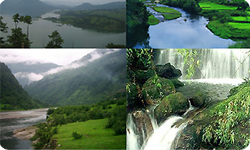
Geography Of Meghalaya

Located in the Northeast region of India, Meghalaya is bounded by Bangladesh on the south and west and Assam on the north and east. With an average annual rainfall of 1,150 cm, the state is the wettest state in India. Main rivers flowing through the landlocked state of Meghalaya are Manda, Janjiram, Damring, Ringge, Ganol, Khri, Umtrew, Simsang, Umiam, Kupli, Umkhem, Kynshi, Umngot Umiam and Mawphlang.
With an area of 22,429 sq km, Meghalaya has diverse range of soil types supporting a variety of agricultural crops including rice, pulses, maize, oilseeds, jute, cotton and mesta. The soil types include laterite, red, red-loamy and yellow soils.
Forests account for around 30 per cent of the land area under the sate of Meghalaya. With a height of 1965 m above seas level, the Shillong peak is the highest point in the state. Floral diversity of Meghalaya can be distributed in 6 types, Alluvial Sal, Foothill and Plateau Sal, Very Moist Sal Bearing Forests, Mixed Deciduous Forests, Evergreen Forests, Bamboo Forests, Grasslands and Assam Sub-Tropical Pine Forests.